| Edward Moseley's 1733 Map of Northeastern NC | Return To Article |
|
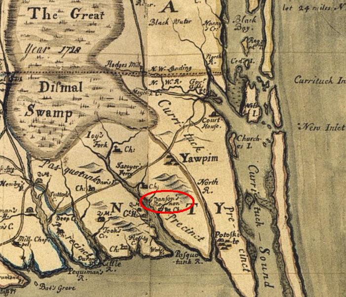
This map was created & published by Edward Moseley in 1733. It depicts the Northeastern portion of NC. The area circled in red on the map below is the region that was known as Danson's Grant, now known as Danson's Manor.
 | |